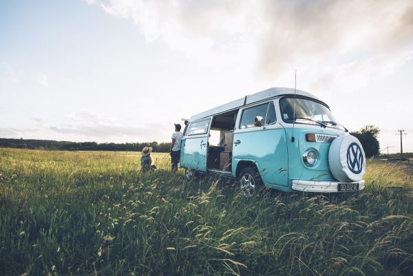


The Normandy South Eure territory, rich in a small local heritage, can be discovered by car or by bike thanks to 5 routes from 32 to 71 km. Take its quiet little roads and discover a mosaic of landscapes, monuments and tourist sites. Let yourself be guided by a map and its road book which, in addition to descriptive and historical information, contains a list of restaurants and places of leisure.
The Route of Flavors and Knowledge
80 km loop starting from Verneuil-sur-Avre (Verneuil d'Avre and d'Iton)
Discover the flavors and the knowledge of this territory of traditions and excellence: craftsmen, master chocolate maker, falconer, collector, farmer producer… This route, not signposted, offers you detours through small, uncrowded roads, with landscapes bucolic. Here and there, you will see a mariette, an orchard, a pond, a cottage… Characteristic elements of the local landscape. Stop off, observe, taste ...
The Route du Grison
95 km loop starting from Verneuil-sur-Avre (Verneuil d'Avre and d'Iton)
The route du grison is located on the former southern border region of the Duchy of Normandy. Richard II, Guillaume Le Conquérant, Henri Beauclerc, Richard the Lionheart then Philippe Auguste were the main builders of the towns, fortresses and religious buildings that dot this territory.
This route offers 8 stages particularly marked by this historical period. Churches, hydraulic works, brotherhoods of charity, dungeons and towers, feudal mounds, fortified gates are some of the sites that you can discover during your journey.
The Mariettes
70 km loop starting from Verneuil-sur-Avre (Verneuil d'Avre and d'Iton)
This circuit allows you to discover these small oratories that line the roads of our countryside. Built sometimes in the public domain, sometimes in private property, the Mariettes bear witness to the faith and gratitude of believers who came to solicit the Virgin Mary, to whom, for the most part, they are consecrated, hence their name. The oldest of these buildings date back two centuries. They have long been the object of individual and collective pilgrimages.
In the Avre valley
34,7 km route from Verneuil-sur-Avre to Breux-sur-Avre.
The Avre has its source in the national forest of Perche. It is in its basin that the water of Paris is collected, conveyed by an aqueduct, for the drinking water needs of the capital. In the Middle Ages, the river marked the border between the Duchy of Normandy and the Kingdom of France, with fortresses in several places, notably in Verneuil-sur-Avre and Tillières-sur-Avre. Discover the heritage of past centuries where castles, manors, churches and aqueducts punctuate your route.
In Breteuil Forest
32 km loop from Breteuil-sur-Iton (Breteuil)
This forest area of 17 hectares is punctuated by a few ponds and of great ecological wealth. Bordered to the south by the forced arm of the Iton and crossed by the Lême stream, this forest is a true haven of peace where Saint-Melain, Bishop of Rennes, chose to found a hermitage there in the 572th century. Crossed by ancient Roman roads, now forest roads, the Breteuil forest is a hiker's paradise.
This route takes place on calm roads, green places, easy to borrow both by car and by bicycle. It allows you to discover the towns and villages of the canton, with their charming paces, with old churches so particular to our region.
The Valley of Iton
62 km route from Bourth to Villalet (Sylvains-les-Moulins)
The Iton river is born in the hills of Perche. It has the particularity of being a watercourse with eclipses. In Bourth, he was first quartered, by royal decision, in forced arms to supply Verneuil and Breteuil. Further on, in Sylvains-les-Moulins, the river disappears into the limestone subsoil for several months a year over ten kilometers. It is then called the Sec Iton. The valley of the Iton crosses plains and forests where farms, thatched cottages, castles, churches, mills and washhouses have settled. Go up its course and experience the tranquility of the small roads of our countryside.